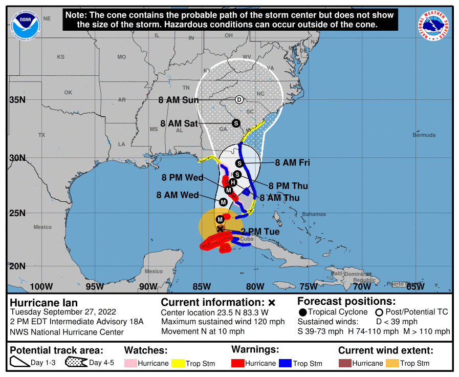
Hurricane Ian Update From the Charleston National Weather Service (9.27.22 | 2:45 PM)
As of the 2pm update, Hurricane Ian is located about 265 miles South of Sarasota, FL, and has maximum stained winds of 120 MPH, moving north at 10 MPH.
Tropical Storm Watch and Storm Surge Watch Issued for our Area
A Tropical Storm Watch means tropical storm-force winds are possible somewhere within this area within the next 48 hours.
A Storm Surge Watch means life-threatening inundation, from rising water moving inland from the coastline, is possible somewhere within this area within the next 48 hours.
|
|

|
The Sea Pines CSA staff is actively monitoring and preparing for the storm.
The Sea Pines CSA Maintenance Department has begun making storm preparations which include:
- Lowering lagoon levels throughout the community
- Securing items at our managed areas
- Ensuring Sea Pines CSA drains and outfalls are clear
- Mobilizing equipment as needed throughout the community
We ask Sea Pines property owners, guest and visitors to please make sure you have your hurricane plan in place, begin to prepare your property, and follow any advice given by local, state or government officials.
Communications from Sea Pines CSA should be secondary to the messages passed from government officials via local TV, radio and emergency management websites. Please monitor local radio and television stations and follow the instructions of emergency officials.
We will continue to keep you updated as we receive information via our communication resources:
- Our website: www.seapinesliving.com/ian
- Our Facebook page at www.facebook.com/SeaPinesLiving
- NEW! Sea Pines CSA Information Hotline 1-843-671-7804: This phone line will play a recorded message with pertinent updates.